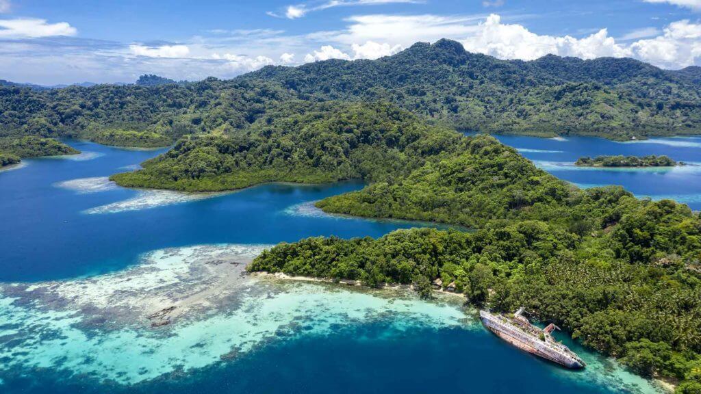
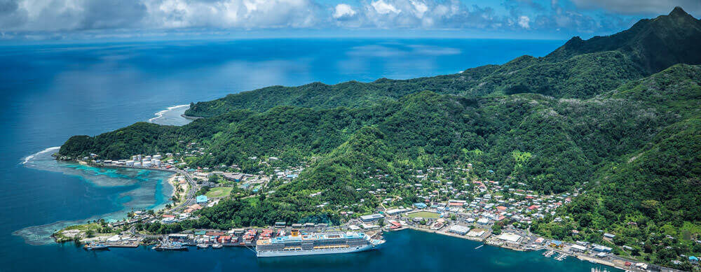
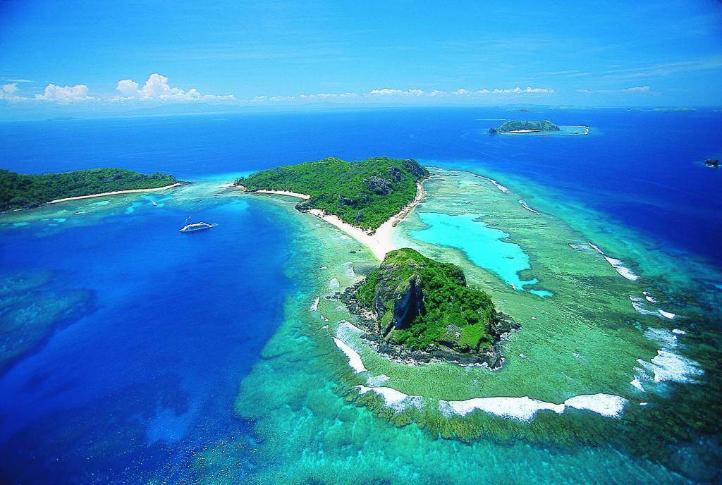
9 countries at risk of disappearing due to climate change
Although global warming is a serious threat to the entire planet, some geographical regions are more vulnerable to its effects.
What are SIDS?
These nations are a part of the so-called SIDS (Small Island Developing States), which are in danger of extinction and will, by their very nature, be the first to experience the effects of climate change.
According to the United Nations Department of Economic and Social Affairs, 52 of these territories primarily share the vulnerability of a tourism-based subsistence economy, the challenge of developing communications and infrastructure, a lack of protection from natural disasters, and a reliance on international trade.
These nine islands are in danger of disappearing because of global warming.
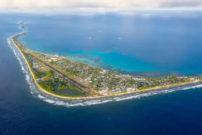
Kiribati
Northeast of Australia, the Republic of Kiribati covers an area of three million square kilometers. Every day and year begin there first in the world’s populated areas. It was found in the 16th century by the Spanish, and it became independent from Britain in 1979.
The rising seas are its main threat. Kiribati is the nation most likely to vanish due to rising sea levels in the coming years because it has an altitude of only three meters and the water rises at a rate of 1.2 centimeters per year (four times faster than the global average).
Territory composition: 33 coral atolls and one island in the Pacific Ocean
Capital: South Tarawa
Population: 102,351 inhabitants in 2013
The Maldives
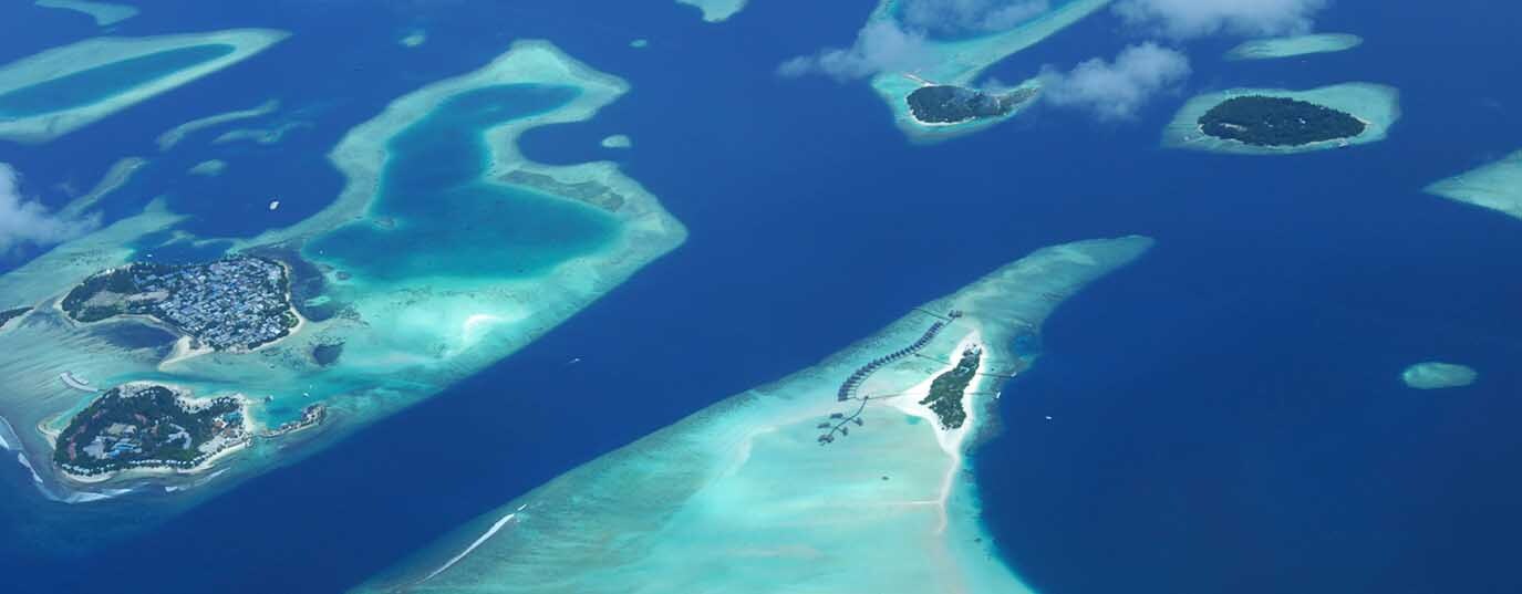
South of India, in a region measuring 298 square kilometers, is the Republic of the Maldives. It was a colony of the British, Dutch, and Portuguese until 1965, when it attained independence.
The main threat to this nation, which is one of the lowest in the world with a point of maximum height of 2.3 meters and the lowest average altitude in the world at just 1.5 meters, is the current sea level rise.
Territory composition: 1,200 islands in the Indian Ocean
Capital: Malé
Population: 345,023 inhabitants in 2013
Vanuatu
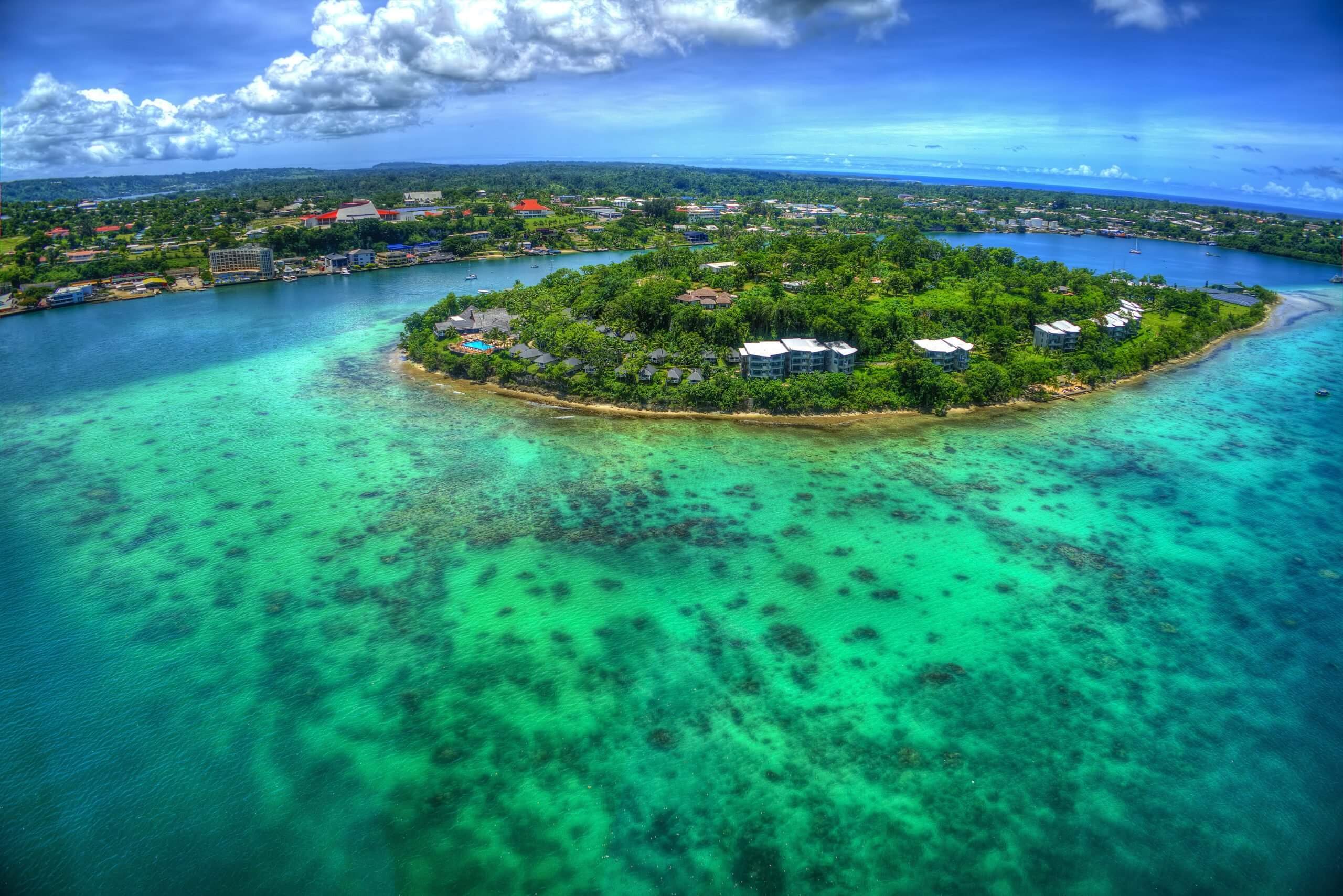
According to the United Nations, the Republic of Vanuatu is the nation that is most susceptible to natural disasters. The archipelago, which measures just over 12,000 square kilometers, was found by Spanish explorers in 1606 and became a new state in 1980 after gaining independence from Great Britain and France, which shared sovereignty over it.
Vanuatu experiences a high rate of cyclone formation in addition to the main risk factor for SIDS, the sea level rise. In fact, 90% of the buildings in the capital were damaged by Cyclone Pam. The disappearance of this island may be caused by global warming.
Territory composition: 83 volcanic islands in the South Pacific
Capital: Port Vila
Population: 207,000 inhabitants in 2005
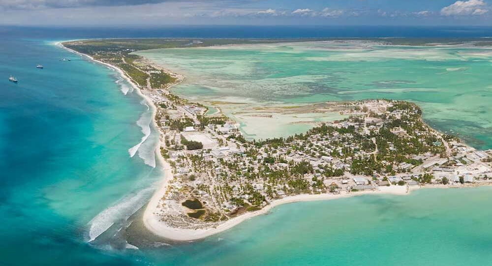
Tuvalu
The predicament of Tuvalu exemplifies the injustice of climate change: it is one of the nations most adversely affected by global warming while producing the least amount of pollution. Tuvalu is a victim of the global warming’s lack of borders because of its low average height above sea level. Emissions from one country directly affect those of another.
The Tuvalu archipelago, which the Spanish first discovered around 1568, declared its independence from Britain in 1978.
Close to Vanuatu, Tuvalu also experienced Cyclone Pam and is at risk of sinking due to global warming, so its government is extremely strict about adhering to the Kyoto Protocol.
Territory composition: Four coral reefs, five atolls and three islands in the Pacific Ocean
Capital: Funafuti
Population: 9,876 inhabitants in 2013
Solomon Islands
Spanish explorers found this tiny island paradise in 1568; it is almost 30,000 square kilometers in size and gained independence from Britain in 1978.
There have been warnings about their difficult survival for more than five years now, as global warming may cause the nation to gradually submerge under the ocean in the coming decades. A significant threat comes from sinking nations.
Territory composition: 990 islands spread in two archipelagos (Solomon and Santa Cruz) in the Indian Ocean
Capital: Honiara
Population: 561,231 inhabitants in 2013
Samoa
Early in the 18th century, European settlers made contact with the less than 3,000 square kilometer Independent State of Samoa, and in the 19th century, the United States, Germany, and the United Kingdom made claims to portions of its territory. In 1962, it separated from New Zealand.
The loss of coral reefs brought on by ocean warming is Samoa’s biggest problem. These organic defenses serve as walls of defense against ferocious waves that find no resistance and are invading and eroding the coastlines.
Territory composition: Seven islands in the South Pacific
Capital: Apia
Population: 190,372 inhabitants in 2013
Nauru
The Republic of Nauru is a region of just over 20 square kilometers with a little-known history because it was uninteresting to the European powers well into the 19th century. After passing through the hands of the German, Dutch, and Australian governments before finally gaining independence in 1968, it was discovered by the British crown.
Due to its low average height, the current sea level rise is its main threat. The survival of the small Nauru population in this region will be seriously endangered in the coming years if the ice melting at the poles continues.
Territory composition: One atoll in the Central Pacific
Capital: Yaren
Population: 10,084 inhabitants in 2011
Fiji Islands
The Republic of Fiji is yet another top-notch tourist destination. Southeast Asians colonized its 1.3 million square kilometer territory before the arrival of Europeans in the 17th century. Up until its declaration of independence in 1970, Fiji was a part of British sovereignty.
Fiji deals not only with the usual issue of sea level rise but also with the ongoing threat of bad weather. In 2009, a prolonged period of rain caused significant damage to the country’s two main sources of income—the sugar cane plantations and the tourism infrastructure—and resulted in 19 fatalities and the evacuation of 9,000 people.
Territory composition: 330 islands in the Pacific Ocean
Capital: Suva
Population: 881,065 inhabitants in 2013
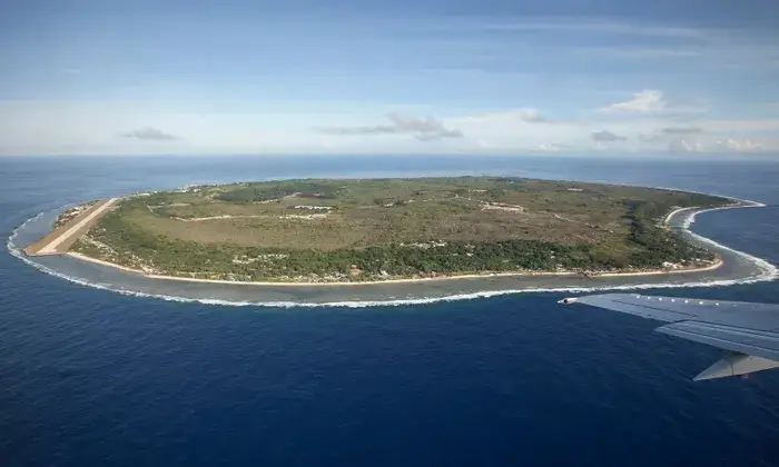
Marshall Islands
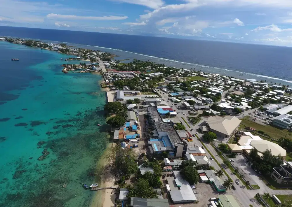
Captain John Marshall, who discovered the islands in 1788, is honored with the name of the Marshall Islands Republic. It became independent from the United States in 1990 and has an area of 181 km2.
In this tiny nation of Micronesia, the impending submersion under water caused by sea level rise is not a threat; rather, it is a fact that has already started and is plainly apparent in some of its atolls, such as in Majuro, where sections of land that were typically visible have been engulfed by the sea.
Territory composition: 29 atolls and five islands in the Pacific Ocean
Capital: Majuro
Population: 70,983 inhabitants in 2014
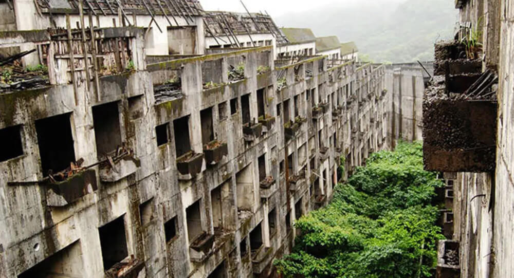
Famous abandoned cities and ghost towns in the world
Learn the stories behind seven of the world's most renowned abandoned cities and villages, from the infamous Chernobyl nuclear catastrophe zone to Hashima Island.
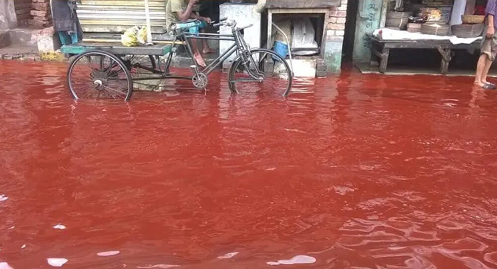
Mystery SOLVED: blood Rain in India
The dissemination of spores of microalgae has been identified as the origin of the 'Blood Rain' phenomena, according to a new study by Indian and Austrian experts. Since 1896, reports of intermittent red-colored rain in portions of Kerala and Sri Lanka have been coming in. The most recent one occurred in 2013 over Kerala.
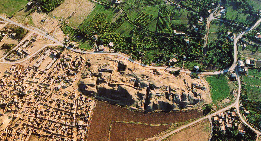
Ancient Jericho: The First Walled City In History
The ancient city of Jericho is the world's oldest walled city, with evidence of stone fortifications dating back nearly 9000 years.
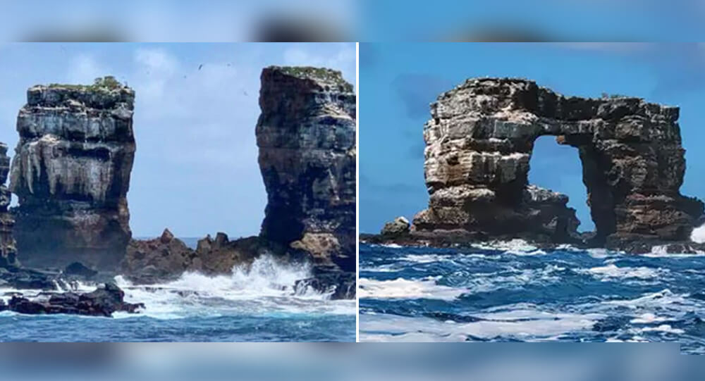
Darwin's Arch collapse
According to news sources, the top of Darwin's Arch, a famous natural stone archway in the northern Galapagos Islands, has collapsed into the waves.
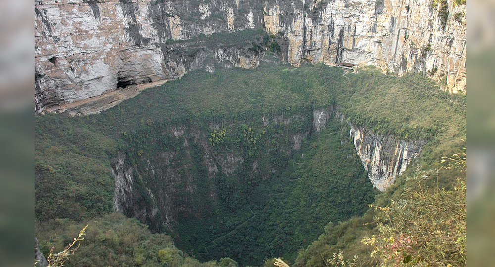
Xiaozhai Tiankeng: Exploring the World’s Deepest and Largest Natural Sinkhole
Hidden in the rugged terrain of Chongqing, China, lies Xiaozhai Tiankeng—the world’s deepest and largest natural sinkhole. Known as the “Heavenly Pit,” this colossal natural wonder plunges between 511 and 662 meters deep and stretches over 600 meters wide, dwarfing many familiar landmarks. This article journeys into the geological origins, unique ecosystem, and mysterious caverns beneath Xiaozhai Tiankeng, revealing a spectacular glimpse into Earth’s hidden landscapes.
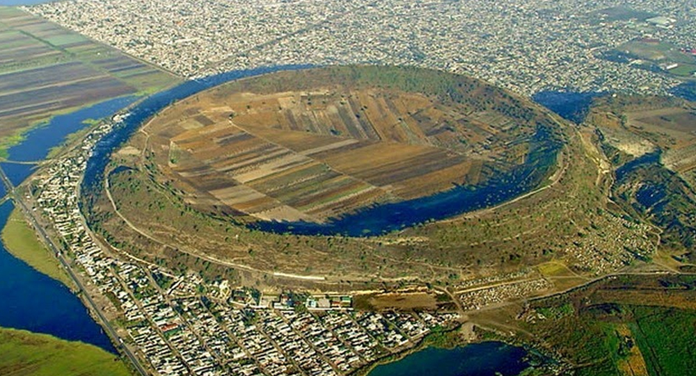
How Xico in Mexico Transformed from Volcano to Lake to Farmland
Xico, located near Mexico City, has a fascinating geological and cultural history that tells a story of transformation—once a violent volcano, then a serene lake, and today a fertile expanse of farmland. This transformation reflects the dynamic forces of nature and human intervention over centuries. This article explores the journey of Xico’s volcanic crater from its fiery origins through its time as a lake and how it ultimately became rich soil supporting agriculture and community life.
Top 10 Mysterious And Least Explored Places On Earth
Some people believe that there is nothing unexplored remaining on earth but the world doesn't cease to surprise us with its mysteries. Today I'll tell you about the lost places of the planet and animals that live only there.
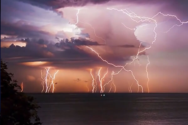
8 most amazing natural phenomena on earth
Nature is elusive and unpredictable, and the unexplained manifestations of its influence often leave us speechless. Though you might believe that shifting rocks and blood-colored rain are a prank or a magical phenomenon, science has an explanation for (almost) anything.

The Benefits of Forest Bathing and Why It’s Gaining Popularity Worldwide
Forest bathing, or Shinrin-yoku, is an immersive practice of spending mindful time in natural forest environments, and it’s rapidly gaining global popularity due to its proven health benefits. From reducing stress and lowering blood pressure to boosting immunity and enhancing mental wellness, forest bathing offers a natural and accessible way to reconnect with nature and improve overall well-being. Explore the science, sensory experience, and rising trend behind this soothing practice.
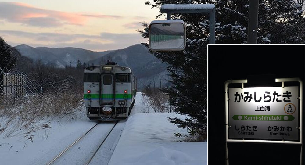
This soon-to-be-closed train station in Japan only serves one passenger
Japan keeps a defunc train station operational in 2015 for the sole purpose of allowing one girl to go to school every day. Only two stops are made by the train: once when an only one high school student departs for school and once when she returns.

Toronto’s Camouflaged Electric Substations
For over a century, Canada’s second-largest power company has been disguising its electrical substations in Toronto as beautiful houses that blend perfectly with the neighborhood. These fake houses contain transformers that supply electricity throughout the city.
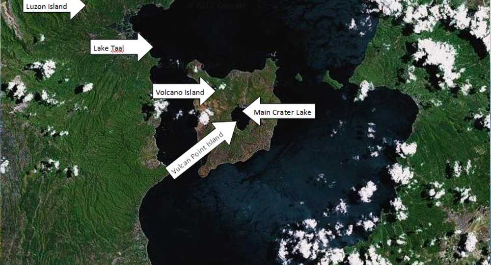
Taal volcano: The Island in a Lake on an Island in a Lake on an Island
Lake Taal, on the island of Luzon, in the Philippines archipelago's northernmost reaches, is unique. It's now one of just two lakes in the world with a third-order island within it, with the lake itself being a part of the order. In other words, Lake Taal, which is located on the island of Luzon, has a volcano (Volcano Island), a lake (Crater Lake), and its own little island (Vulcan Point).
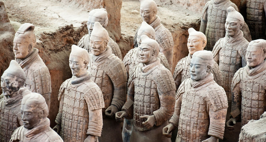
Top 10 Greatest and shocking Archaeological Discoveries of All Time
While we're all locked at home, there's no better way to escape to another time and place than to learn about amazing archeological sites and discoveries from around the world. Here are the 10 greatest and shocking archaeological discoveries —and don't be shocked if they inspire future trip plans whenever it's safe to do so again.
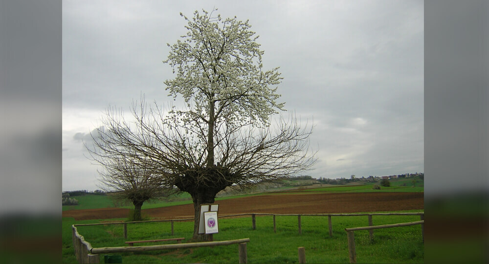
The Unique Grana Double Tree of Piedmont, Italy
The “Grana Double Tree” in Piedmont, Italy is a highly unusual tree, which consists of a cherry tree growing atop a mulberry tree. It is essentially a two-species, two-tiered hybrid duplex.
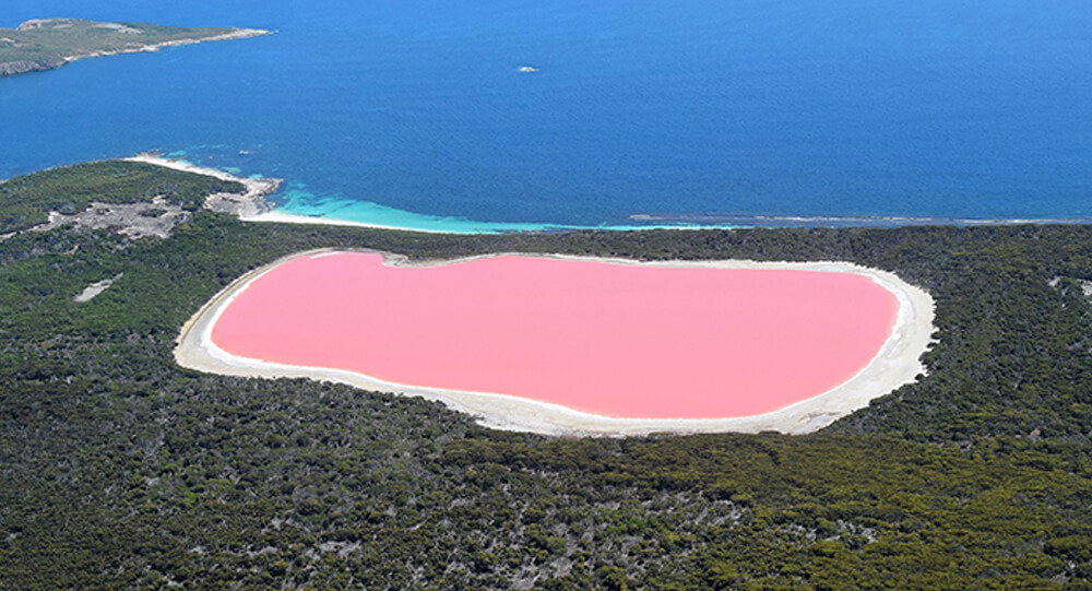
What is secret behind the Australia’s mysterious pink lake?
Lake Hillier in Australia maintains a bright pink hue all year round. Although no one knows for sure what causes the unique coloring, experts speculate that it might be the result of high salinity, a pink bacteria called “halobacteria,” and a salt-loving algae species called Dunaliella salina.
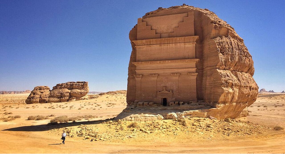
Qasr al-Farid, the Lonely Castle of the Nabataeans
The remote tomb of Qasr al-Farid, situated in the Saudi Arabian desert, dates back to the 1st Century CE. It was built by the Nabataean people, who also built Petra in Jordan. This site has remained largely undisturbed.
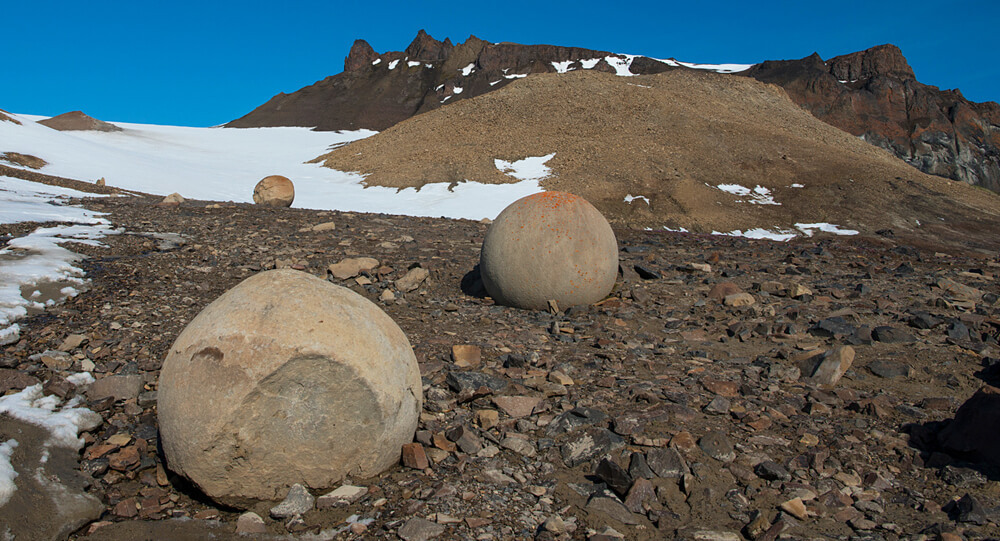
The mysterious GIANT spherical stones
Mysterious spherical stones ranging in size from a few millimeters to several meters have been discovered in Crimea, United States, Russia, and New Zealand. There are many theories from various geologists, but none of them are clear.
Grüner See, The Park That Turns Into A Giant Lake Naturally
There is a place in Austria called Grüner See which is a dry park in winter and turns into a 12-meter-deep lake in summer.
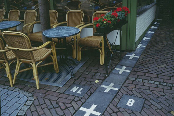
Coolest and unique international boarders you must see
Not only do borders define us, but they also determine who we are. Simple lines on the ground, either man-made or geological, distinguish one culture from the next.
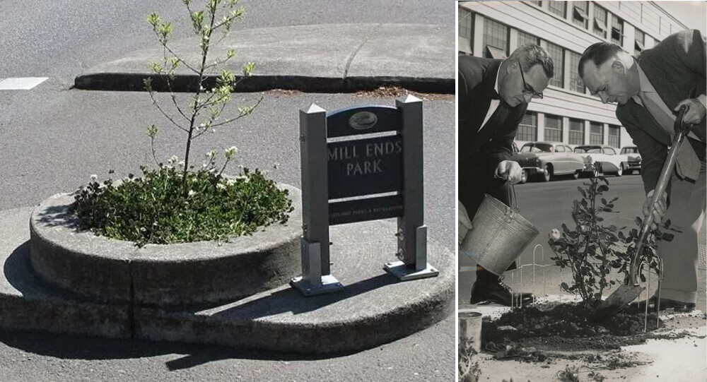
Mill Ends Park, the Smallest Park in the World
Portland, Oregon is home to the tiniest park in the world, a two-foot-diameter circle. Mill End Park is the name of this park.
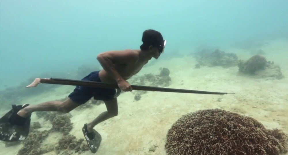
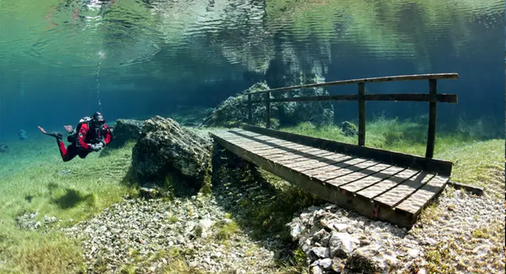
The unusual ability of 'sea nomads' to hold breath is due to one major organ
The Bajau are a group of people that practice extreme free diving, submerging for up to 13 minutes at depths of about 200 feet. These ‘sea nomads’ dive to catch fish or look for natural materials that can be used in crafts in the waters that surround the Philippines, Malaysia, and Indonesia.

The story behind Glasgow's iconic Duke of Wellington statue and its well-known traffic cone hat
The city of Glasgow spends approximately £10,000 every year to remove traffic cones from the head of the Duke of Wellington statue. The Duke of Wellington statue, which first appeared in the early 1980s, has worn an orange traffic cone hat for decades. but how did it get there - and more importantly how did it stay?
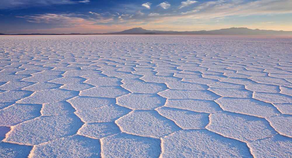
The world's largest salt flat, can be seen in space
At 10,582 square kilometers (4,086 sq mi), the Salar de Uyuni (or Salar de Tunupa) is the largest salt flat in the world. It is located in the Potosi and Oruro departments in southwest Bolivia, near the crest of the Andes, and is elevated 3,656 meters (11,995 ft) above the mean sea level.

Poland's Krzywy: The Mysteries of the Crooked trees
In Poland, there is a forest with 400 crooked trees that have a 90-degree bend at the base of their trunks. Despite of numerous possibilities, the real reason and how it evolved remain a mystery.
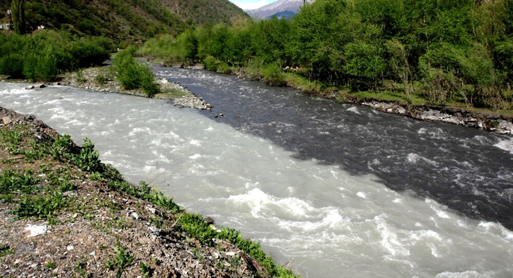
When two rivers meet but do not mix in Georgia
The incredible Black and White Aragvi river in Georgia that do not mix up.