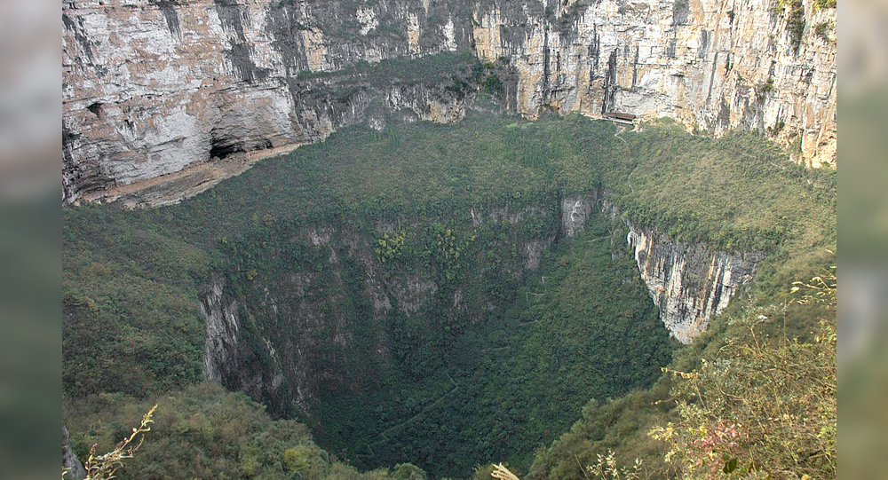
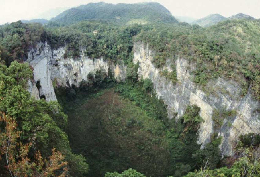
Xiaozhai Tiankeng, also known as the “Heavenly Pit,” redefines the scale of natural sinkholes. Located in Fengjie County, Chongqing Municipality, China, it measures approximately 626 meters (2,054 feet) long, 537 meters (1,762 feet) wide, and plunges between 511 and 662 meters (1,677 to 2,172 feet) deep—making it the deepest and largest known sinkhole on Earth.
To put this into perspective, the pit’s depth is nearly twice the height of the Empire State Building. The opening covers an area of about 274,000 square meters, approximately equivalent to 38 soccer fields. Such immense scale gives Xiaozhai Tiankeng a unique place in geological and natural history.
The Double-Nested Structure: Two Bowls in One Giant Pit
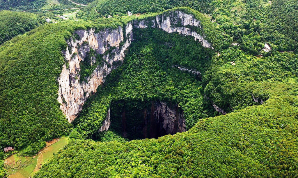
Xiaozhai’s striking geology features a double-nested structure, meaning the sinkhole consists of two distinct “bowls” or steps, separated by a large sloping ledge formed by soil trapped in the limestone.
The upper bowl descends roughly 320 meters (1,050 feet), while the lower bowl plunges an additional 342 meters (1,122 feet). The diameter of each bowl averages between 257 and 268 meters (843 and 879 feet), highlighting the sinkhole’s complexity.
This nested arrangement reflects the process of progressive limestone erosion and collapse over tens of thousands of years, representing a spectacular example of karst topography—a landscape shaped by the dissolution of soluble rocks.
Geological Origins: Water and Time as Sculptors
Xiaozhai Tiankeng formed over the Difeng cave system, carved out through relentless erosion by an underground river. This subterranean river begins in Tianjin fissure gorge, flowing about 8.5 kilometers (5.3 miles) underground before plunging out at the sinkhole’s base as a majestic 46-meter (151-foot) waterfall that feeds the Migong River.
Over an estimated 128,000 years, acidic rainwater and groundwater dissolved limestone bedrock, creating underground voids. When the cavern ceilings could no longer withstand their weight, they collapsed repeatedly, enlarging the sinkhole and carving out the impressive double-bowl shape seen today.
The median annual flow rate of the subterranean river is about 8.77 cubic meters per second but can surge to 174 cubic meters per second during rainy seasons, accelerating erosion and shaping this geological marvel.
A Hidden Ecosystem: Flora and Fauna in the Pit
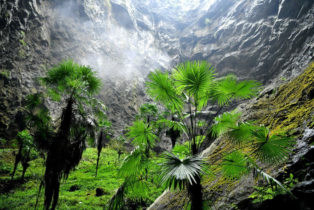
Despite its immense depth and vertical walls, Xiaozhai Tiankeng shelters a remarkable biodiversity. Scientists have identified more than 1,285 plant species within the pit, including ancient species like ginkgo trees—a “living fossil” dating back millions of years.
Animal life thrives as well. Rare species such as the elusive clouded leopard and the endangered Chinese giant salamander inhabit the sinkhole’s microclimates, benefiting from its seclusion from human disturbance.
The “Heavenly Pit” thus functions like a natural biosphere, preserving pockets of ancient and rare life forms in a vertical, enclosed environment.
Discovery by the Outside World and Scientific Expeditions
Although locals have long known about the pit, the outside world “discovered” Xiaozhai Tiankeng only in 1994, when British and Chinese speleologists attempted detailed exploration and mapping.
Despite rigorous efforts, navigating its underground river systems proved extraordinarily difficult. Over a decade, multiple expeditions mapped portions of the cave but were stopped by strong currents and submerged passages. Thus, much of Xiaozhai’s subterranean mysteries remain unexplored.
Researchers also used advanced 3D laser scanning and drone technology to measure and visualize the vertical cliffs and internal structure, enabling better understanding while minimizing human risk.
Visiting Xiaozhai Tiankeng: Tourism Meets Nature
Today, a 2,800-step staircase allows adventurous tourists to descend into the rim of the pit to appreciate its vast scale and breathtaking views. The surrounding region supports several ecotourism ventures, leveraging the sinkhole’s allure.
Visitors can witness, especially during the rainy season, spectacular waterfalls cascading into the maw of the Earth, watch unique flora bloom along the steep walls, and explore trails surrounding this geological wonder.
Despite tourism, conservation efforts emphasize protecting the fragile ecosystem inside the sinkhole from human impact, balancing access with preservation.
Fascinating Trivia About Xiaozhai Tiankeng
- Xiaozhai Tiankeng literally means “Little Village Heavenly Pit,” named after a nearby abandoned settlement.
- It is the largest sinkhole by volume in the world at about 119 million cubic meters.
- Some vertical walls reach heights that make rappelling and rock climbing challenging for even the most experienced adventurers.
- The underground river beneath the sinkhole has a height drop of 364 meters over its 8.5-kilometer course, producing strong flow rates.
- Ginkgo trees inside the sinkhole represent species dating back over 200 million years to the Triassic era.
- Cave pearls, smooth polished stones, have been discovered inside the pit’s caverns, formed over centuries.
- The “Heavenly Pit” pools a microclimate, allowing species to survive at depths despite surface aridity.
- Large sinkholes like Xiaozhai likely formed due to a combination of tectonic activity and chemical erosion over geological timescales.
The Geological and Ecological Importance of Xiaozhai Tiankeng
In addition to its status as a record-breaking natural sinkhole, Xiaozhai Tiankeng offers critical insights into earth’s geological history, karst processes, and underground water systems.
Understanding such formations helps scientists study groundwater flow, rock stability, and climate effects over millennia. Ecologically, Xiaozhai is a natural laboratory for studying isolated ecosystems and species conservation in extreme, enclosed environments.
Its preservation is vital for sustained scientific research and fostering global awareness of unique karst landscapes threatened by development and climate change.
Final Thoughts: Entering the Earth’s Majestic “Heavenly Pit”
Xiaozhai Tiankeng captivates with its sheer size, geological complexity, and ecological richness. It offers a rare glimpse into deep Earth processes and the tenacity of life in isolated natural marvels.
By exploring this immense sinkhole, scientists, adventurers, and nature lovers alike connect with the planet’s dynamic forces and biodiversity, reminding us of the hidden wonders beneath our feet.
If Xiaozhai’s stunning tale of geology and life inspired awe, share this article to illuminate one of Earth’s greatest subterranean treasures.
Sources & Further Reading:
- Wikipedia: Xiaozhai Tiankeng (2013)
- IFLScience: China’s Xiaozhai Heavenly Pit, Deepest Sinkhole (2023)
- BBC Travel: Xiaozhai Tiankeng, The World’s Biggest Sinkhole (2022)
- National Park Service: Karst Landscapes and Sinkholes
- ScienceAlert: Massive Sinkholes and Cave Complexes in China (2018)
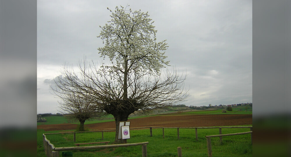
The Unique Grana Double Tree of Piedmont, Italy
The “Grana Double Tree” in Piedmont, Italy is a highly unusual tree, which consists of a cherry tree growing atop a mulberry tree. It is essentially a two-species, two-tiered hybrid duplex.
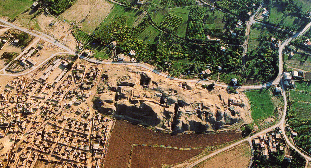
Ancient Jericho: The First Walled City In History
The ancient city of Jericho is the world's oldest walled city, with evidence of stone fortifications dating back nearly 9000 years.

Why Londoners Celebrate No Trousers Day by Riding the Metro Without Pants
Every year, Londoners participate in a quirky and joyful tradition known as No Trousers Day, where brave commuters board the London Underground dressed normally but without trousers, pants, or pajamas from the waist down. This cheeky event brings laughter, surprises, and a shared sense of community to the usually dull winter commute, reflecting a playful rebellion against the mundane and a celebration of spontaneity. Discover the origins, spirit, and fun behind London’s beloved No Trousers Tube Ride.
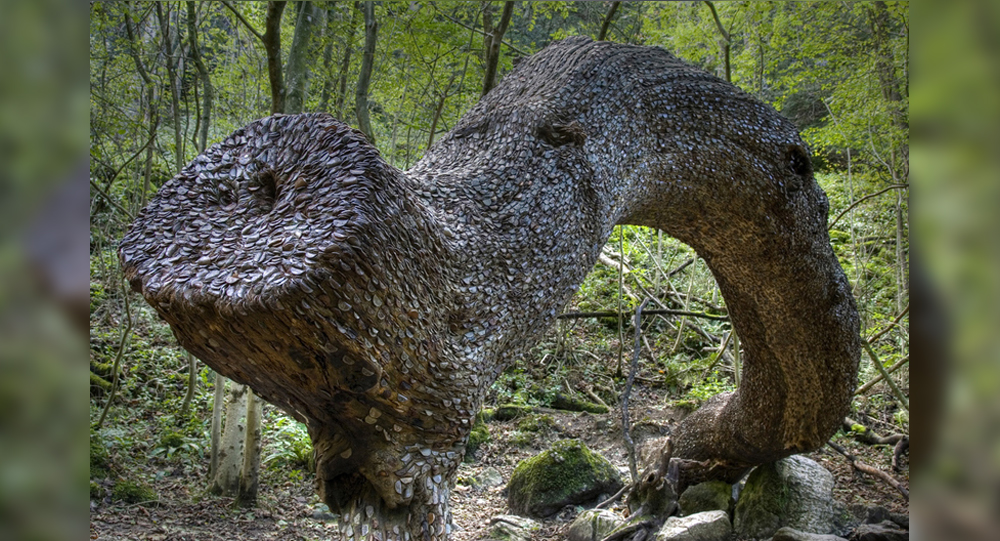
The Mystical Money Tree of the Scottish Highlands: A 1,700-Year-Old Tradition
In the Peak District Forest of the Scottish Highlands in the UK, there is a unique tree which is laden with only money. This tree laden with money has been studded with British coins for 1700 years, there is no corner of its trunk where a British coin is not stuck.

Mystery SOLVED: blood Rain in India
The dissemination of spores of microalgae has been identified as the origin of the 'Blood Rain' phenomena, according to a new study by Indian and Austrian experts. Since 1896, reports of intermittent red-colored rain in portions of Kerala and Sri Lanka have been coming in. The most recent one occurred in 2013 over Kerala.
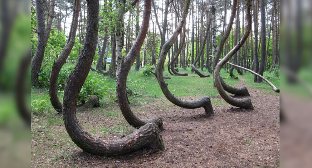
Poland's Krzywy: The Mysteries of the Crooked trees
In Poland, there is a forest with 400 crooked trees that have a 90-degree bend at the base of their trunks. Despite of numerous possibilities, the real reason and how it evolved remain a mystery.
Top 10 Greatest and shocking Archaeological Discoveries of All Time
While we're all locked at home, there's no better way to escape to another time and place than to learn about amazing archeological sites and discoveries from around the world. Here are the 10 greatest and shocking archaeological discoveries —and don't be shocked if they inspire future trip plans whenever it's safe to do so again.
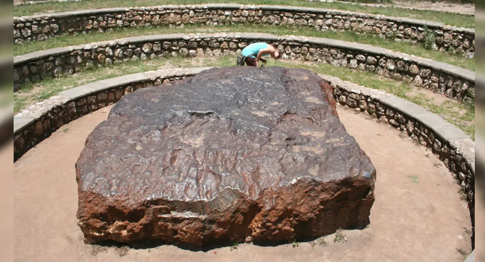
Top 6 Largest Meteorites Ever Found on Earth
When space meteorites hurtle towards Earth, they frequently burn up in the atmosphere before reaching us. Those that burn up become meteors - or shooting stars.
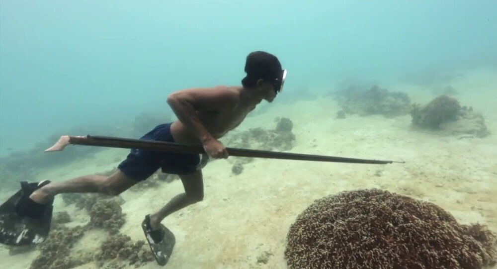
The unusual ability of 'sea nomads' to hold breath is due to one major organ
The Bajau are a group of people that practice extreme free diving, submerging for up to 13 minutes at depths of about 200 feet. These ‘sea nomads’ dive to catch fish or look for natural materials that can be used in crafts in the waters that surround the Philippines, Malaysia, and Indonesia.
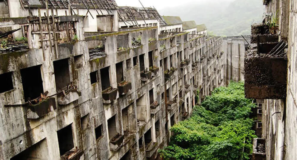
Famous abandoned cities and ghost towns in the world
Learn the stories behind seven of the world's most renowned abandoned cities and villages, from the infamous Chernobyl nuclear catastrophe zone to Hashima Island.
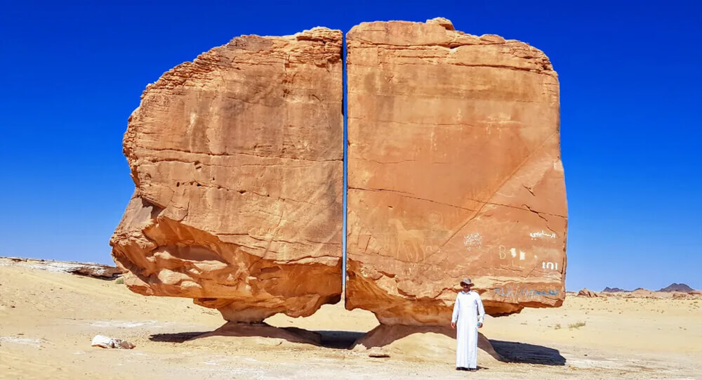
How Were the Two Parts of the Al Naslaa Rock Formation Created?
Scientists have been puzzled by the Al Naslaa rock formation in Saudi Arabia for a long time, and there is still no explanation for why this boulder appears to have a precise incision across the middle of it.

8 most amazing natural phenomena on earth
Nature is elusive and unpredictable, and the unexplained manifestations of its influence often leave us speechless. Though you might believe that shifting rocks and blood-colored rain are a prank or a magical phenomenon, science has an explanation for (almost) anything.
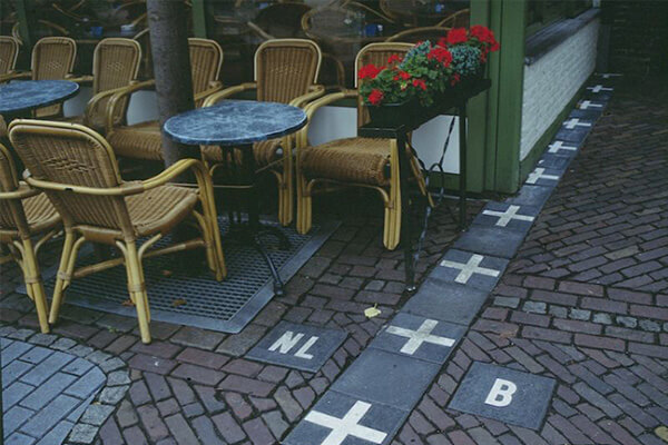
Coolest and unique international boarders you must see
Not only do borders define us, but they also determine who we are. Simple lines on the ground, either man-made or geological, distinguish one culture from the next.
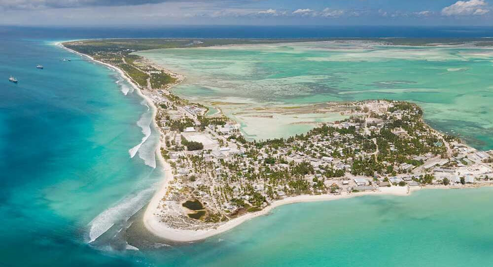
9 countries at risk of disappearing due to climate change
Although global warming is a serious threat to the entire planet, some geographical regions are more vulnerable to its effects.
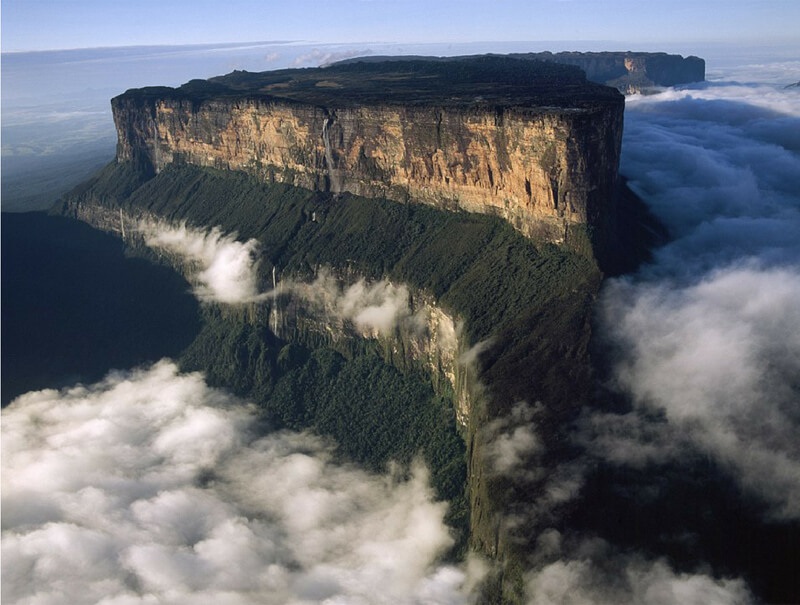
Top 10 Mysterious And Least Explored Places On Earth
Some people believe that there is nothing unexplored remaining on earth but the world doesn't cease to surprise us with its mysteries. Today I'll tell you about the lost places of the planet and animals that live only there.
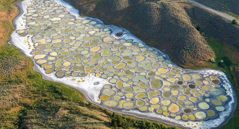
The Mystery of Canada's Magical Spotted Lake
Lake Khiluk, the world's most mineralized lake, and one of the most mysterious places on Earth. Each of these spots has a distinct chemical content and is said to cure various diseases.
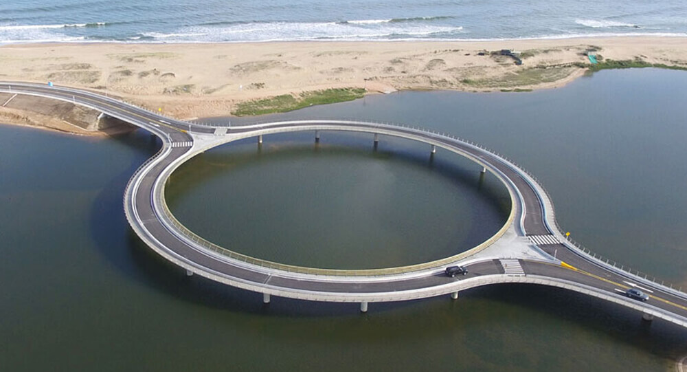
Circular Bridge Built To Slow Down Drivers So That They Would Enjoy The View (Photos)
Uruguay’s Laguna Garzon Bridge splits into a circle so drivers can slow down and enjoy the view. It also prevents head-on collisions and creates a walkway for pedestrians.

The Tiny Street in Scotland That Holds the Record as the World’s Shortest
Nestled in the northern Scottish town of Wick, Ebenezer Place may be small, but it packs a world record punch. Measuring only 6 feet 9 inches (2.06 meters) long and boasting just a single address—the front door of Mackay’s Hotel—this narrow street has earned its place in the Guinness Book of World Records as the shortest street on the planet. Officially declared a street in 1887, Ebenezer Place delights visitors with its quirky charm and unique history that highlights how even the tiniest places can capture global attention.
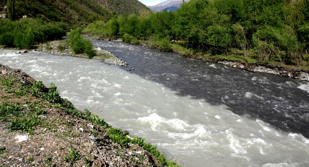
When two rivers meet but do not mix in Georgia
The incredible Black and White Aragvi river in Georgia that do not mix up.

The story behind Glasgow's iconic Duke of Wellington statue and its well-known traffic cone hat
The city of Glasgow spends approximately £10,000 every year to remove traffic cones from the head of the Duke of Wellington statue. The Duke of Wellington statue, which first appeared in the early 1980s, has worn an orange traffic cone hat for decades. but how did it get there - and more importantly how did it stay?

How Migratory Birds Navigate Thousands of Miles Without Getting Lost
Migratory birds undertake epic journeys spanning thousands of miles with astonishing precision, never losing their way. Their secret lies in a remarkable blend of innate senses, learned experience, and sophisticated navigation tools—ranging from the Earth's magnetic field to celestial clues and mental maps. Explore how these feathered travelers accomplish one of nature's most astounding feats through science, intuition, and adaptation.
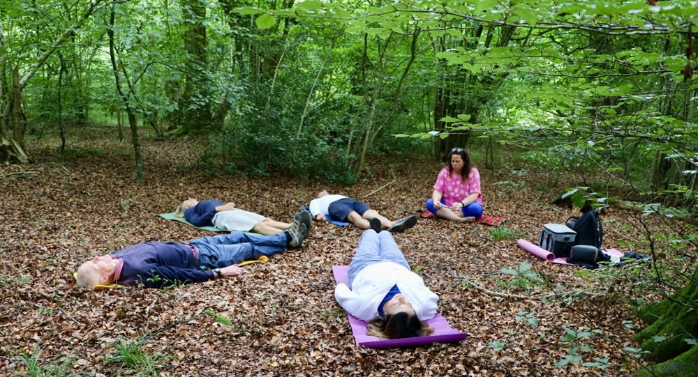
The Benefits of Forest Bathing and Why It’s Gaining Popularity Worldwide
Forest bathing, or Shinrin-yoku, is an immersive practice of spending mindful time in natural forest environments, and it’s rapidly gaining global popularity due to its proven health benefits. From reducing stress and lowering blood pressure to boosting immunity and enhancing mental wellness, forest bathing offers a natural and accessible way to reconnect with nature and improve overall well-being. Explore the science, sensory experience, and rising trend behind this soothing practice.
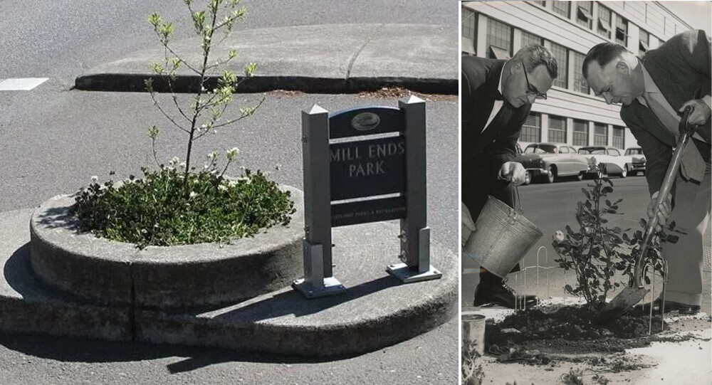
Mill Ends Park, the Smallest Park in the World
Portland, Oregon is home to the tiniest park in the world, a two-foot-diameter circle. Mill End Park is the name of this park.

Sandy Island: The Phantom Island That Fooled Maps and Google Earth for Centuries
Sandy Island, charted since 1774, was long considered a phantom island in the Coral Sea. Despite appearing on maps and Google Earth, it was "undiscovered" by scientists in 2012, revealing only deep ocean instead of land. The island's existence was likely a cartographic error or a misidentified pumice raft.
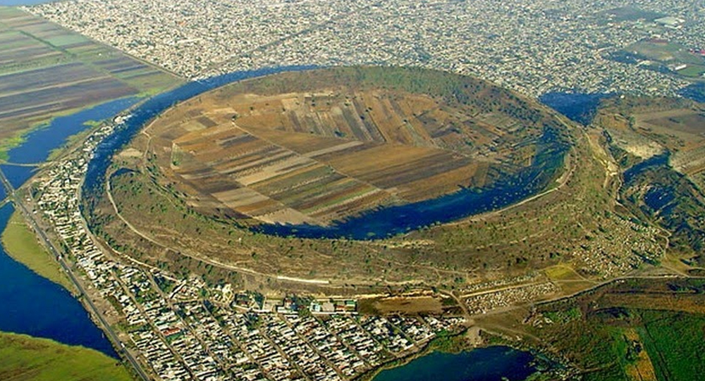
How Xico in Mexico Transformed from Volcano to Lake to Farmland
Xico, located near Mexico City, has a fascinating geological and cultural history that tells a story of transformation—once a violent volcano, then a serene lake, and today a fertile expanse of farmland. This transformation reflects the dynamic forces of nature and human intervention over centuries. This article explores the journey of Xico’s volcanic crater from its fiery origins through its time as a lake and how it ultimately became rich soil supporting agriculture and community life.